


bapech_roucan

yt34
User
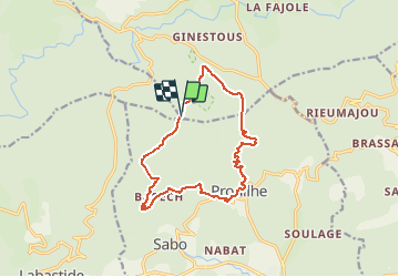

Length
13.9 km

Max alt
959 m

Uphill gradient
515 m
Km-Effort
21 km

Min alt
528 m

Downhill gradient
512 m
Boucle
Yes
Creation date :
2014-12-10 00:00:00.0
Updated on :
2014-12-10 00:00:00.0
--
Difficulty : Unknown

FREE GPS app for hiking
 SityTrail
IGN / Geographical institutes
SityTrail Plus
The world is yours!
About
Trail Walking of 13.9 km to be discovered at Occitania, Hérault, Le Soulié. This trail is proposed by yt34.
Description
rando solher
Positioning
Country:
France
Region :
Occitania
Department/Province :
Hérault
Municipality :
Le Soulié
Location:
Unknown
Start:(Dec)
Start:(UTM)
473840 ; 4817898 (31T) N.
Comments